









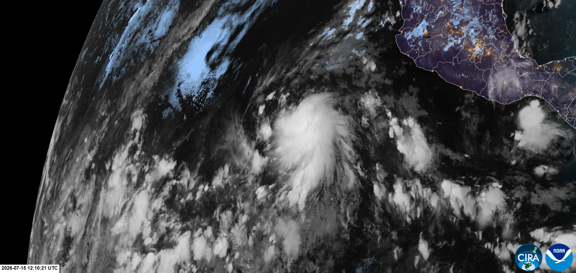





















Tropical Storm Elida formed early Wednesday in the Eastern Pacific, roughly 560 miles south-southwest of the southern tip of Baja California, as a strengthening El Niño fuels an active start to the basin's hurricane season.
Elida has maximum sustained wind speeds of 40mph and is not expected to threaten land, the National Hurricane Center (NHC) said.
Elia is forecast to strengthen into a hurricane Thursday night and would become the first hurricane in the Eastern Pacific this season.
LATEST FROM FOX WEATHER HURRICANE SPECIALIST BRYAN NORCROSS
This is the fifth named storm produced by the basin. Amanda, Boris, Cristina, Douglas and now Elida have all formed ahead of their average climatological dates.
On average, the fifth named storm of the Eastern Pacific season forms around July 23.
Elida's eventual remnants could have an impact on the continental U.S.
"It will be worth watching for the possibility of remnant tropical moisture eventually entangling with the monsoon rains across the Southwestern U.S. later this week," the FOX Forecast Center said.
Meanwhile, there are three other areas being monitored across the Central and Eastern Pacific for topical development.
Two are located south of Hawaii, one with a medium chance of development over the next two days and the other with a low chance. These systems are expected to remain well south of Hawaii.
Another area to watch, several hundred miles off the coast of southern Mexico, is being given a high chance of development over the next seven to 10 days.
Looking further ahead, long-range forecasts from NOAA's Climate Prediction Center (CPC) are highlighting an increased chance of tropical development closer to Hawaii in late July.
This comes amid a rapidly strengthening El Niño in the Central Pacific.
El Niño typically enhances tropical development in the Eastern Pacific due to the warm water temperatures.
El Niño is one of three phases of a climate cycle called the El Niño-Southern Oscillation (ENSO). It describes natural temperature changes in the central Pacific Ocean that alter atmospheric circulation and can greatly influence global weather.
El Niño describes warmer than average water across the equatorial Pacific, while La Niña describes colder than average water conditions, and ENSO neutral refers to a state where temperatures are close to average.
El Niño conditions have historically favored above-average tropical activity across the Eastern Pacific. On average, the basin produces 15 named storms, 8 hurricanes, and 4 major hurricanes (Category 3 or stronger).
According to NOAA, a historically strong El Niño is likely to develop this fall. NOAA said there is an 81% chance that this El Niño will rank among the strongest on record this fall, up from a 63% chance in its June outlook.
ODDS INCREASE AGAIN FOR DEVELOPMENT OF SUPER EL NIÑO BY THIS FALL
When water temperatures in the El Niño zone reach at least 2 degrees Celsius above average for at least three consecutive months, it is considered a Super El Niño.
The post Tropical Storm Elida forms as strengthening El Niño fuels active Eastern Pacific hurricane season appeared first on Fox Weather