






























THE TAKEAWAY
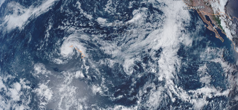
With Lala leaving Hawaii in the rearview, a string of new tropical threats is emerging as atmospheric conditions across the Pacific set the stage for a second act.
After Lala brought heavy rain, strong winds, flash flooding and widespread power outages, attention is turning to a few areas across the Pacific, with signs of possible tropical development as hurricane season kicks into high gear.
Further east, a developing disturbance currently moving toward the Central Pacific trailing behind Lala's path, has a medium chance of development.
As the clean-up across the Hawaiian Islands from Lala begins, this new system is worth keeping a close eye on with a chance the disturbance approaches the island chain.
HOW THE BIGGEST WAVES IN THE WORLD BREAK OFF THE COAST OF PORTUGAL
Strong persistent high pressure to the north of the system is expected to force the storm on a firmly westward-to-west-southwestward track, likely keeping the disturbance's circulation suppressed well south of the Hawaiian chain, according to the FOX Forecast Center.
With the track ensuring the system's primary core remains over open waters, the main footprint of the islands will likely be limited to elevated outer moisture bands and increased swells later in the week rather than a direct tropical strike.
With the area worth keeping an eye out, the FOX Forecast Center will continue to monitor the storm that could approach Hawaii on the heels of Lala.
In the East Pacific Basin, conditions are primed for robust development as another system takes shape in an area being monitored for tropical development, with the ongoing influence of El Niño playing a major role.
According to the FOX Forecast Center, computer forecast models show a strong area of low pressure consolidating within a very rich moisture environment, an area that has been marked by the National Hurricane Center (NHC) as an area to watch with a medium chance for development off the coast of Mexico.
WHAT’S THE DIFFERENCE BETWEEN A TROPICAL DEPRESSION, TROPICAL STORM AND HURRICANE?
With the system forecast to develop over the warm waters of the Pacific toasted by El Niño, it is expected to become a hurricane as it tracks west-northwestward over the next several days.
At this point, there are two primary scenarios for how this storm unfolds as it grows.
The first keeps a strong subtropical ridge anchored to the north, steering the system on a more traditional westward track across the open Pacific and away from any land.
MASSIVE METEOR TURNS PACIFIC NORTHWEST NIGHT SKY ELECTRIC BLUE
The second involves a weakness developing in the ridge, which could allow the storm to gain latitude and curve further north.
While the system remains far out in the Pacific and there is still considerable uncertainty surrounding its eventual track, FOX Weather will continue to monitor its development, forecast trends and any potential impacts in the days ahead.
The post Lala is moving on, but the Pacific is already showing new signs of tropical activity appeared first on Fox Weather