




















THE TAKEAWAY
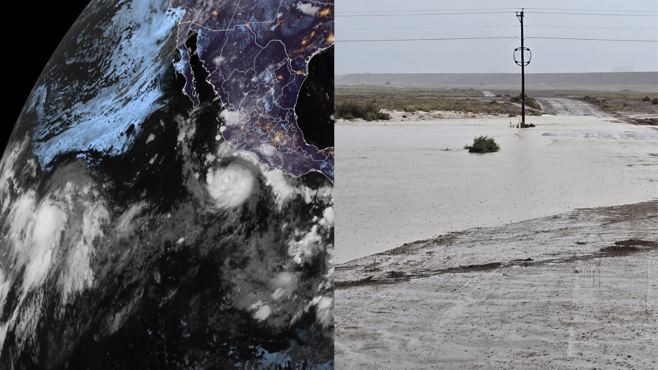
Tropical Storm Polo strengthened into Hurricane Polo Monday afternoon and is expected to rapidly intensify into a major hurricane with moisture forecast to enhance the flood threat across the U.S.Southwest beginning Tuesday.
The National Hurricane Center (NHC) is now monitoring four areas of tropical activity across the Pacific, including Polo.
This comes amid a rapidly strengthening El Niño which has supercharged the Pacific, producing 18 named storms across both the Central and Eastern parts of the basin with more than two months remaining in the hurricane season.
Hurricane Polo is a Category 1 storm currently about 270 miles southwest of cities along Mexico's southwest coast, and is moving East at 5 mph, with sustained winds of 80 mph, according to the NHC.
While it will not make landfall anywhere near the U.S., moisture from Polo is already streaming into the Southwest and is expected to enhance monsoon thunderstorms over New Mexico, beginning Tuesday.
LATEST FROM FOX WEATHER HURRICANE SPECIALIST BRYAN NORCROSS
Polo is expected to make a sharp turn northwest, away from the Mexican coast by late Tuesday, but not before bringing destructive hurricane-force winds, coastal storm surge and torrential rain capable of triggering catastrophic mudslides to Mexico's southwestern and west-central coasts.
A Tropical Storm Watch is in effect from Tecpan De Galeana to Punta San Telmo.
According to the NHC, Polo is expected to rapidly intensify into a major hurricane (Category 3+) by Wednesday as it parallels the Mexican coast.
Polo may not ever make a true landfall along the coast; currently, many forecast models have Polo's center staying away from land and eventually moving out into the open Pacific.
However, Polo's moisture is fueling a dangerous flood threat over the Southwest, just a week after flooding enhanced by a different tropical disturbance killed three people near Newcomb, New Mexico.
Monsoon thunderstorms are expected to break out Tuesday through Thursday, primarily across New Mexico.
THE HIGHEST-ELEVATION TORNADOES IN US HISTORY
"Widespread heavy rainfall will lead to a risk of life-threatening flash flooding across much of the state," the National Weather Service (NWS) in Albuquerque said.
A Level 3 out of 4 flash flood threat covers parts of southern New Mexico on Tuesday, including Las Cruces.
The Level 3 flood threat will shift north and east on Wednesday, covering Roswell, with heavy rain expected across Albuquerque as well.
Meanwhile, Tropical Storm Odalys is churning in the open Pacific, more than 1,000 miles southwest of Baja California. Odalys currently has sustained winds of 45 mph and is expected to gradually strengthen into a hurricane by midweek.
Odalys is forecast to turn back in the direction of Mexico towards the end of the workweek.
Depending on Polo's track, the two storms could begin to interact and may bring additional moisture into the Southwest.
"Some computer forecasts show Odalys interacting with Polo in some fashion in several days," FOX Weather Hurricane Specialist Bryan Norcross said.
WHAT ARE KELVIN WAVES? EL NIÑO’S HIDDEN THREAT THAT COULD IMPACT SEVERAL STATES ON THE WEST COAST
"If predictions are right, Polo will be the stronger storm and will dominate, but each can still influence the track of the other, which adds uncertainty to the forecast," he continued.
Hawaii, which generally doesn't see much tropical activity, could see another tropical system after being impacted by three systems this season, including destructive Hurricane Lowell.
The remnants of former Tropical Depression Fifteen-E, located well east-southeast of Hawaii, are moving towards the state.
Conditions are becoming more likely that Fifteen-E will redevelop into at least a tropical depression. Even if this system does not fully reorganize into a tropical depression or named storm, it will still bring heavy rain across the islands starting Wednesday, the FOX Forecast Center said.
The heaviest rain is expected to begin across the Big Island, parts of which were ravaged by Hurricane Lala, late Thursday.
Between 8 and 12 inches of rain could fall through the weekend over the Big Island, including Hilo. Wind gusts could also reach between 30 and 40 mph as this system makes a close approach.
Meanwhile, the NHC is monitoring an area to watch for tropical development south of the Gulf of Tehuantepec, several hundred miles southwest of Polo. It's being given medium odds of developing over the next seven days.
Check back for updates on this developing story.
The post Polo now a Category 1 hurricane, expected to strengthen and fuel Southwest flood threat amid active Pacific appeared first on Fox Weather