




















THE TAKEAWAY
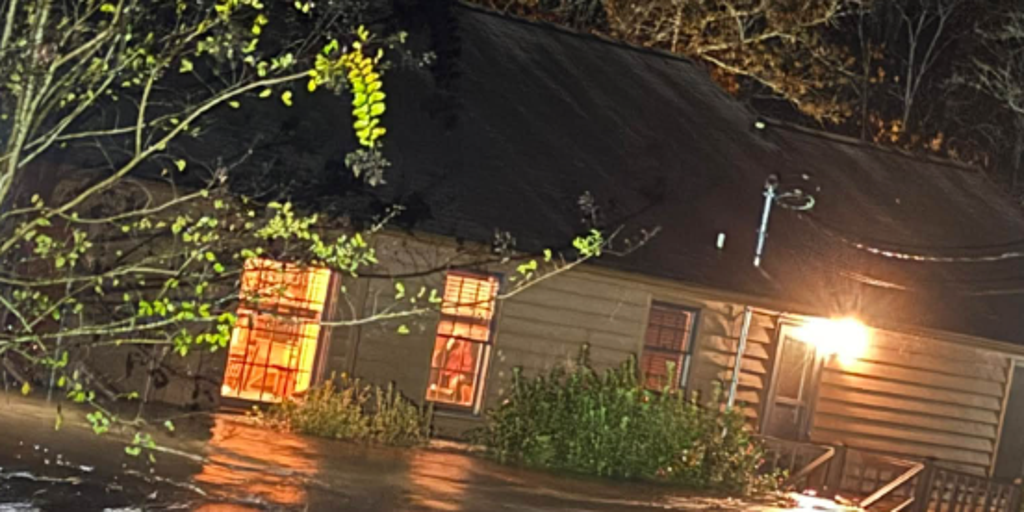
Torrential rain triggered Flash Flood Emergencies across Polk County, Tennessee, and Fannin County, Georgia, along the state line early Thursday after storms fired along the southern end of a massive cross-country storm that will move into the East Coast through the day.
WHAT IS A FLASH FLOOD EMERGENCY?
Police in McCaysville, Georgia, asked people in some neighborhoods to evacuate immediately just before 3 a.m. local time. County officials said swiftwater rescues were underway amid widespread flooding with water into multiple homes.
The City of McCaysville declared a state of emergency just after 5 a.m.
The flooding caused a propane tank to catch fire in a local business in McCaysville, Georgia.
The Ocoee River surged into major flood stage after between 5 and 8 inches of rain fell across much of the region over just 12 hours.
Georgia State Patrol helicopters are on standby to assist with evacuations, the Fannin County Emergency Management Agency said.
The City of Copperhill, Tennessee, said early Thursday that the city is closed and warned people to stay away from the downtown or any areas along the river.
Polk County, Tennessee, announced all schools would be closed Thursday.
WHEN IS THE EARLIEST SNOWFALL ON RECORD FOR PARTS OF THE NORTHEAST?
Showers and storms will rumble into the East Coast through the day on Thursday, bringing an end to a more than two-week stretch of dry, sunny weather across parts of the Northeast.
More than an inch of rain is possible across much of the Interstate 95 corridor, with localized amounts approaching 2–3 inches along the coast from Virginia to southeast New England.
The rain will continue through Friday and is expected to taper off through the day from south to north.
On Friday, a Level 1 out of 4 flash flood risk covers parts of Suffolk County on New York's Long Island and parts of eastern Connecticut and southeast Massachusetts. A Level 2 threat includes Newport and Providence, Rhode Island, as well as parts of southeastern Massachusetts.
Rain will linger across southern New England through Saturday morning.
Much of the Northeast has seen its longest dry streak of the year. New York City, Philadelphia and Boston have all gone over 2 weeks without measurable rain, with drought conditions ongoing across New England, particularly Maine.
The rain could help ease dry conditions, although downpours may cause minor flooding.
COULD SUPER EL NIÑO INFLUENCE THE POLAR VORTEX TO DO SOMETHING IT'S NEVER DONE BEFORE THIS WINTER?
Heavy rain could linger into Saturday morning across the Northeast.
Severe storms raced across the South Tuesday, prompting Tornado Warnings across northern Louisiana.
FOX Weather Exclusive Storm Tracker Brandon Copic captured footage of a tornado that touched down in Bossier Parish, Louisiana, late Tuesday morning.
Meanwhile, parts of the Southwest are still reeling from flooding this past weekend.
Roads remain closed due to residual flooding and damage left behind by historic floods.
HOW FLOODWATER CAN MAKE YOU VERY SICK
Police in Flagstaff, Arizona, said they are investigating a second death as potentially being weather-related after finding a body in a stormwater drainage area on Monday.
Evacuations remain in effect in communities near the San Juan River in New Mexico and Colorado.
The post Intense rain triggers Flash Flood Emergency at Tennessee-Georgia border as cross-country storm shifts east appeared first on Fox Weather